Your Guide to The Sitia UNESCO Global Geopark
Your Guide to The Sitia UNESCO Global Geopark


☞ Table of Contents:
Greece is a playground for adventurous souls… Or maybe Greece is the adventure itself, and we’re simply privileged to share in its soul. As soon as you meet Greece there is an unexplainable urge inside you to see, feel, touch, and experience. To become one with the land.
There are over 200 islands dotting the story-soaked Aegean. Rugged mountainous slopes hide secrets of ancient gods, whose myths have shaped civilizations. Architectural wonders give us a glimpse into the ingenuity of our past.
The choices are endless. Whether in the rough of the winter blues or the peak of summer, Greece never fails to give you a feeling you always want to come back to.
One of our favorite places to find it is in the Sitia Geopark.
The area of Sitia has been declared a UNESCO Global Geopark since 2015. A relatively new concept, it aims to preserve the natural and cultural elements of a region while increasing awareness of the geological issues confronting our earth.
In simple terms? Humans help the Earth so future generations can enjoy the same breathtaking natural creations we love.
As UNESCO explains: “Geoparks are single, unified geographical areas where sites and landscapes of international geological significance are managed with a holistic concept of protection, education and sustainable development.”

Where Is The Sitia Geopark?
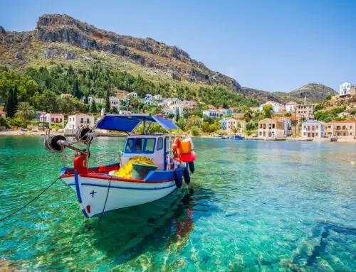
The Sitia UNESCO Geopark is located at the easternmost end of Crete.
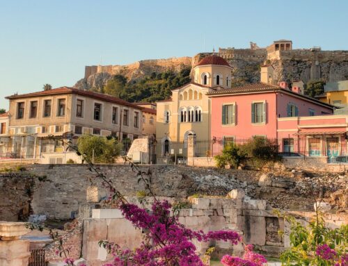
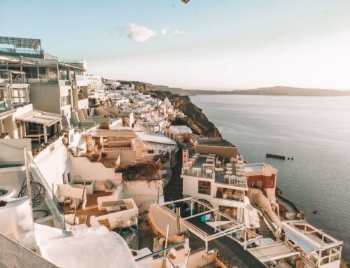
Crete, the largest island in Greece and the fifth largest in the Mediterranean is a unique and unparalleled destination. Unlike Mykonos, Santorini, or other northern beauties, Crete stands alone. It is a land of ruggedly carved beaches, delicious cuisine, friendly locals, and untamed nature.
All the ingredients for an unforgettable adventure, right?
The Sitia UNESCO Geopark
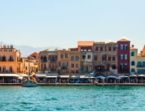
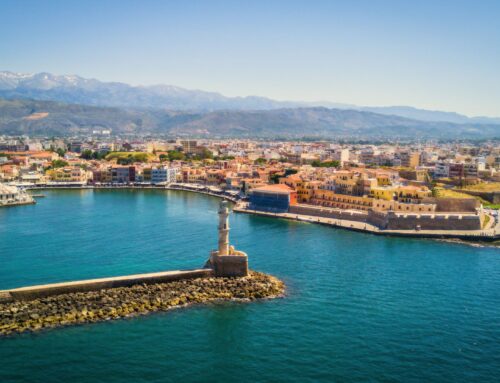
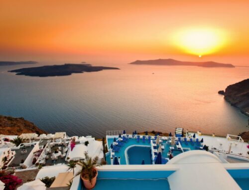
If you have a couple of weeks to spare, I recommend you give Crete the attention it deserves! Start your adventure in the west near Chania: stroll through the Old Venetian Harbor, swim with friendly goats at Seitan Limania beach, soak in the stunning waters of Balos beach, and conquer the Samaria Gorge.
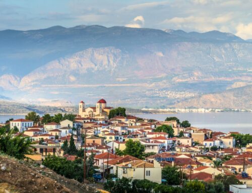
Then, grab a rental car and cruise east towards Heraklion. Don’t miss Rethymno, a quiet town with overwhelming charm. As you continue, take in the stunning slopes of the Psiloritis UNESCO Global Geopark (or dive deeper if you dare). Then slowly, stopping wherever the road takes you, make your way to Sitia.
Sitia has 517 square kilometers of untouched nature, including the only palm tree forest in Europe. You can explore around 20 georoutes that take you through charming villages, mysterious caves, stunning waterfalls, and ancient Minoan ruins. Discover Byzantine churches, Venetian forts, abandoned Neolithic quarries, and fascinating archaeological sites. There are also rock climbing fields, a Caretta-Caretta turtle sanctuary, and countless other attractions, all packed into the Sitia Geopark.
Geosites To See in Sitia Geopark
As of 2024, there are 90 geosites identified in the Sitia UNESCO Geopark. Beyond the villages, beaches, and Minoan settlements, these ‘Geosites’ are areas of significant importance and unique geological heritage to the region. From ancient caves to stunning rock formations and hidden beaches, each site offers a glimpse into the Earth’s dynamic history and the natural beauty of Sitia.
We’ll start with some of the most notable Geosites in the Sitia before diving into the hiking trails and beaches.
Vreiko Cave
One of the most famous caves of the region is the Latsida Vreikou Cave (more often known simply as Vreiko Cave). It is only 2 kilometers from the village of Pefki and gives you a front-row show of stunning stalagmites and stalactites. The cave slices through layers of ancient limestone, stopping only when it hits the water-impermeable Phyllite-Quartzite unit below.
Getting there is half the fun. A short hike takes you to the entrance, hidden behind a fig tree that acts like nature’s secret door. Once inside, stairs and metal bars help you navigate the descent safely. Don’t try to explore on your own. It is always recommended you proceed with extreme caution and an expert in caving to guide you.
📍 GPS – 35.08181083035615, 25.997935743776505
Megali Kefala Schists
Megali Kefala is worth every step of the 5-kilometer hike (geotrail 14) required to get there.
The colorful beach will reward you with calm, turquoise waters and pebbly shores, perfect for a refreshing swim. The cliffs surrounding the beach are a geological wonder, featuring vibrant, multi-colored metamorphosed Phyllite-Quartzite rock that gives a purple hue to the landscape. Natural caves along the shoreline provide cool, shaded spots to relax.
📍 GPS – 35.23778839358838, 26.271080601663055

Argilos Clay Beach
South of the village of Xerokambos lies Argilos Beach, known as Crete’s ‘nature spa’.
The beach’s soft, clay-rich sedimentary rocks, dating back to the Pliocene era, are perfect for a bit of post-hike pampering. All you need to do is dig a little and spread the white clay all over your body. As it dries, you’ll start to feel its magic—exfoliating your skin, improving blood circulation, and soothing any irritations. Just remember to wash off the clay before you leave, since taking home pieces of the geopark is highly prohibited.
📍 GPS – 35.03850125041111, 26.2314213710001
Violet Schists
After you visit the charming fishing village of Mochlos and lunch on some seafood, make your way to the Violet Schists near the port. These ancient rocks, part of the Phyllites-Quartzites unit, date back 260-270 million years to the Lower-Middle Permian period—millions of years before the Minoan civilization even thought of existing. Composed of highly metamorphosed siltstones and shales, with occasional layers of pelagic limestone, these rocks hold a fascinating geological story told through vibrant colors of purple, red, green and brown.
📍 GPS – 35.183113595173225, 25.899162839852515

Vai Fold
After enjoying your soak in Vai Beach, explore the impressive Vai Fold.
These volcano-sedimentary rocks, including quartzitic sandstones and siltstones, form the base of the Tripoli unit’s stratigraphic column.
At the viewpoint above Vai, you’ll see a striking vertical isocline fold, where the rock layers dramatically bend, showcasing Earth’s dynamic processes.
📍 GPS – 35.252976667291954, 26.265561426
Epano Zakros Spring
Epano Zakros Spring is a fascinating natural wonder formed at the junction of two permeable Tripolitsa limestone formations and the impermeable metamorphic rocks of the Phyllite-Quartzite unit. Water travels through the caves of Zakros mountains and emerges at this spring, nourishing the entire surrounding region.
This spring not only irrigates the area but also supports vital ecosystems stretching all the way to Kato Zakros.
📍 GPS – 35.114979371181334, 26.211661570164082
Agioi Pantes Rock Formations
Just west of Sitia, the small gorge of Agioi Pantes features some of the most spectacular rock formations. Shaped by water and wind, these Miocene limestone rocks display vibrant shapes and colors. The intense yellows, combined with various rock oxides, create a beautiful natural palette. You will also find fossils of bivalves and sea urchins surviving in the folds.
📍 GPS – 35.21750413812426, 26.067785992
Fangromouro Cave Hippopotamus
Hidden within the Pleistocene brecciated floor of the Fangromouro Cave are the remnants of Crete’s dwarf hippos, tiny relatives of the large hippos you might think of today.
These fascinating pygmy hippos once roamed the island’s prehistoric swamps and forests, while their modern cousins are now found in West Africa. If you’d like to see the fossils up close you can inquire at the local info center about guided tours or educational opportunities.
📍 GPS – 35.090129395574394, 26.265657293492236

Kato Zakros Gorge
The Kato Zakros Gorge has earned a famous nickname through the years: “Canyon of the Dead.” Instead of using the ground as a cemetery, the ancients would bury their dead within the canyon walls. The gorge covers the last section of the famous European E4 trail. Begin your journey from Epano Zakros and make your way towards the archaeological site of Kato Zakros.
📍 GPS – 35.09822197198593, 26.256412941164182

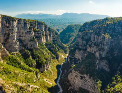
Richtis Gorge and Waterfall
Richtis Gorge is a stunning narrow ravine carved through ancient rocks known as Phyllites-Quartzites, dating back about 360 million years. These rocks include schists, gneiss, amphibolites, metavolcanic rocks, and some marbles.
The unique shape of the gorge and its waterfalls is a result of intense erosion. The more resistant amphibolites and metavolcanic rocks contrast with the easily eroded schists and gneiss, creating terraces and multiple small waterfalls. The highlight is the famous large waterfall, complete with a serene lake in the middle of the gorge where you can rest for a refreshing dip.
📍 GPS – 35.184533940683124, 25.986905466164078
Mazida Ammos Beach
Mazida Amos is a beautiful beach located in a bay just south of Xerokambos, bordered by three charming islets. You can easily drive there along a scenic coastal road.
With its long stretch of white sand, turquoise waters, and shady tamarisk trees, it’s the perfect spot to relax.
📍 GPS – 35.03627341537643, 26.21941171116589
Chiona Salt Marsh
Near the seaside town of Paleokastro, home to the famous Venetian Castle, you’ll discover a minor salt marsh that forms a seawater lake. It’s a fascinating aquatic ecosystem preserved through the Sitia Geopark.
Nearby, you will also find Chiona Beach. It got its name from the carob warehouses (chiones) that once stored the area’s abundant carob harvest.
📍 GPS – 35.196643030653995, 26.277319076820493
Psili Ammos Sand Dunes
South of Vai you will find the Psili Ammos Beach, a captivating stretch of coastline renowned for its distinctive sand dunes. These low sand dunes, known as Aeolian coastal sand deposits, are shaped by the relentless coastal winds. Spanning the entire beach, they create a unique and ever-changing landscape.
📍 GPS – 35.2513332709401, 26.26724176865642

Vai Palm Tree Forest
The palm tree forest of Vai might just be Sitia’s biggest attraction and one of Crete’s most unique features—arguably even all of Greece.
Legends abound about how these palm trees got here. Some say they were brought by Arab pirates, others claim Saracen pirates who hid in the area planted them, and one story even credits Phoenician sailors who supposedly colonized this part of Crete. However, scientists have rained on that parade, proving that the Vai palm trees are an ancient, endemic species native to Crete.
Today, Vai is home to over 5,000 palm trees, creating a surreal landscape that offers both a tropical vibe and ample shade for the stunning beach nearby.
📍 GPS – 35.25451231173219, 26.264220578095802
*Disclaimer: This page might include affiliate links. If you decide to book something through one of them, I might get a little bonus, but it won't cost you anything extra.*